This is an old revision of the document!
Generating Star Maps
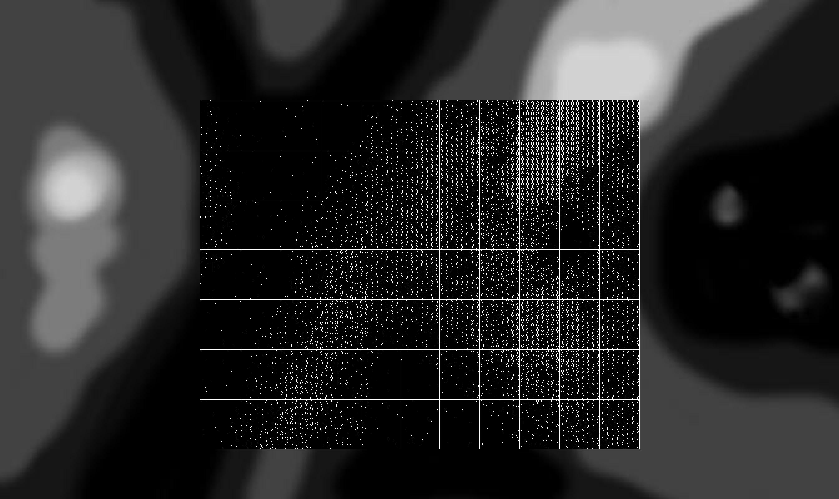
I'm starting to re-write my Traveller-style star system mapper, and my current step is allowing the creation of a galaxy (or at least, part of a galaxy) from a simple density map. The idea is that you can draw what you want your star map to roughly look like by creating a grey scale image which shows the relative densities of star systems in different areas. Black areas have very few star systems, white areas are densely populated with star systems.
The mapping software will then take that and generate a distribution of star systems across Sectors of space using this density map. The sample image shows dark regions which represent an underpopulated rift, with a bright densely populated region at the top right.
The centre of the image is overlaid with a grid of Sectors that shows the actual generated star systems, with the core Sector (0,0) right in the centre. Using a density map allows the geography of local space to be easily sketched out, and then procedural generation can do the rest.
A similar technique could be used to define different civilisations, types of stars or level of colonisation.